
Once you have selected the layer icon, you need to choose map you want to view.
If you click the arrow next to the default option it will show a drop down menu of choices. Please familiarise yourself with these to help you with queries.
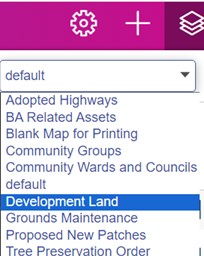
Some of the common used maps are:
Default
The default layer will show you an overview and an extensive key of boundaries, garage ownership, BA drains, culverts, sheltered properties, leasehold properties amongst other options.
Adopted Highways
This map is best used if you are looking to understand if Bron Afon own a piece of land.
Grounds Maintenance
This map project provides clarity on the responsibility of ground maintenance across our operational area in Torfaen, between Bron Afon and TCBC.
Tree Preservation Order
This map will show all trees in Torfaen as green circles. Any on purple land will be Bron Afon’s responsibility.